About BayernInfo Maps
BAYERNINFO MAPS offers "route planning for cars" and "travel information for bus & train" in one app - and all for free! Surprises along the way are becoming rarer. Knowing construction sites, closures and delays in...
BAYERNINFO MAPS offers "route planning for cars" and "travel information for bus & train" in one app - and all for free!
Surprises along the way are becoming rarer. Knowing construction sites, closures and delays in advance means less stress and lower travel costs. And if something unforeseen happens on the way, you always have alternative route recommendations at hand.
BAYERNINFO MAPS provides the most important information for planning your trip:
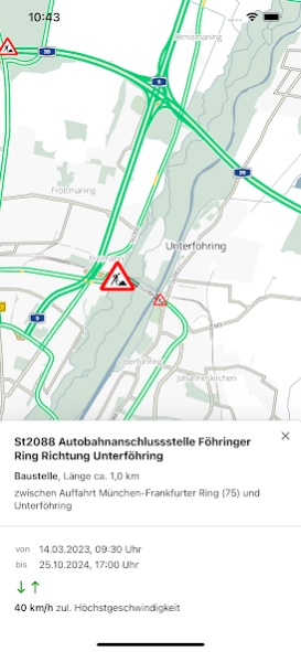
- Current traffic situation with all known construction sites, closures and traffic reports for all of Bavaria
- Images from around 500 traffic cameras along the motorways, federal and state roads in Bavaria and neighboring regions (due to current developments in Europe, the images from the traffic cameras are only available to a limited extent until further notice)
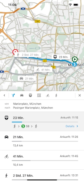
- Intermodal route planning for cars, buses and trains, on request also for Park & Ride, bicycles and pedestrians
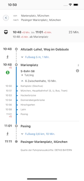
- Stops and POIs - Current departure times and delays in public transport
- Construction site calendar for the phone version
- Route overview: current delay times on selected routes at a glance
Finally, a brief explanation of the purposes for which the app requires certain permissions:
- Precise location (GPS): Necessary to display your own position and for routing from / to your own location
- Full internet access: Required to access the server-side services (map, location and route search)
- Access to protected memory: Necessary for caching (intermediate storage) of map data
Services from the BayernInfo project were co-financed by the European Union.
BAYERNINFO MAPS - mobile information - relaxed on the way - arrive safely
Previous Versions
Here you can find the changelog of BayernInfo Maps since it was posted on our website on 2023-07-03 23:41:47.
The latest version is 4.5.1 and it was updated on 2024-04-23 08:31:08. See below the changes in each version.
BayernInfo Maps version 4.5.1
Updated At: 2023-08-15
Changes: Für PKW-Parkplätzen, Haltestellen und Ladesäulen kann man nun genau einstellen, welche Untergruppen gezeigt werden sollen.
BayernInfo Maps version 4.5.0
Updated At: 2023-08-03
Changes: - Anzeige von E-Ladesäulen
- Anzeige von Wettermeldungen
- Viele kleine Verbesserungen
BayernInfo Maps version 4.3.4
Updated At: 2023-03-14
Changes: - Informationen über Güterverkehrszentren
- Verlinkung zu weiteren Informationen bei Baustellen möglich
- Fehlerbehebungen
Disclaimer
Official Google Play Link
We do not host BayernInfo Maps on our servers. We did not scan it for viruses, adware, spyware or other type of malware. This app is hosted by Google and passed their terms and conditions to be listed there. We recommend caution when installing it.
The Google Play link for BayernInfo Maps is provided to you by apps112.com without any warranties, representations or guarantees of any kind, so access it at your own risk.
If you have questions regarding this particular app contact the publisher directly. For questions about the functionalities of apps112.com contact us.